
When I first head of Squadrats I thought it was “Squad Rats” like some sort of cool bike gang name. It is not. I think it comes from Quadrat. Anyway, it’s a web site/service that tracks where you’ve been. It could be by walking, hiking, or biking. It’s sort of a game? I don’t play though, I just like to see my own data.
Check out the rules.
- Leave your house.
- Record your activity with a phone or any GPS device.
- Collect squadrats.
Ride, run, walk, swim, boat, but use your own muscles, wind, or gravity. Motor vehicles (except e-bikes) are not allowed.
So yeah, it’s sort of a game like Pokémon GO I guess…
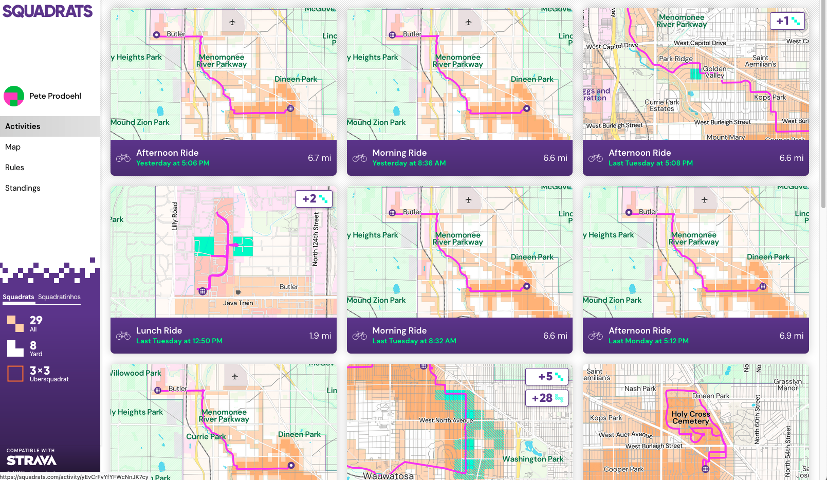
To use Squadrats you need to get your data into Squadrats. When I do a bike ride (or a walk) I use my Apple Watch to “start a workout”. Last year I started using (the free version of) RunGap to get a better view of my bike riding data than (the free version of) Apple Fitness gives me. I still use RunGap, which is great for some things. If you want to export your data from RunGap you have to pay though. (Note: You can get your data in a SQLite database if you use the “backup” feature, which is free… I should write up a post about that.)
Where was I? Oh yeah! RunGap made me wish there was a feature where I could see all of my rides on a single map so I thought about ways to do that on my own. None were easy, so I started looking for solutions and found Squadrats. Data can get to Squadrats via Strava, but I don’t use Strava. Well, I didn’t use Strava, but I do now, because it’s the way to get my ride data from Apple Fitness/Health to Squadrats… Strava is the intermediary between the two.
But Strava is weird for me, because I feel like it’s also a “competition thing” and I don’t care about competing with people, I just want my data to flow somewhere. Strava makes it look like I ride a bike really fast, but I’m just on an ebike commuting to work.
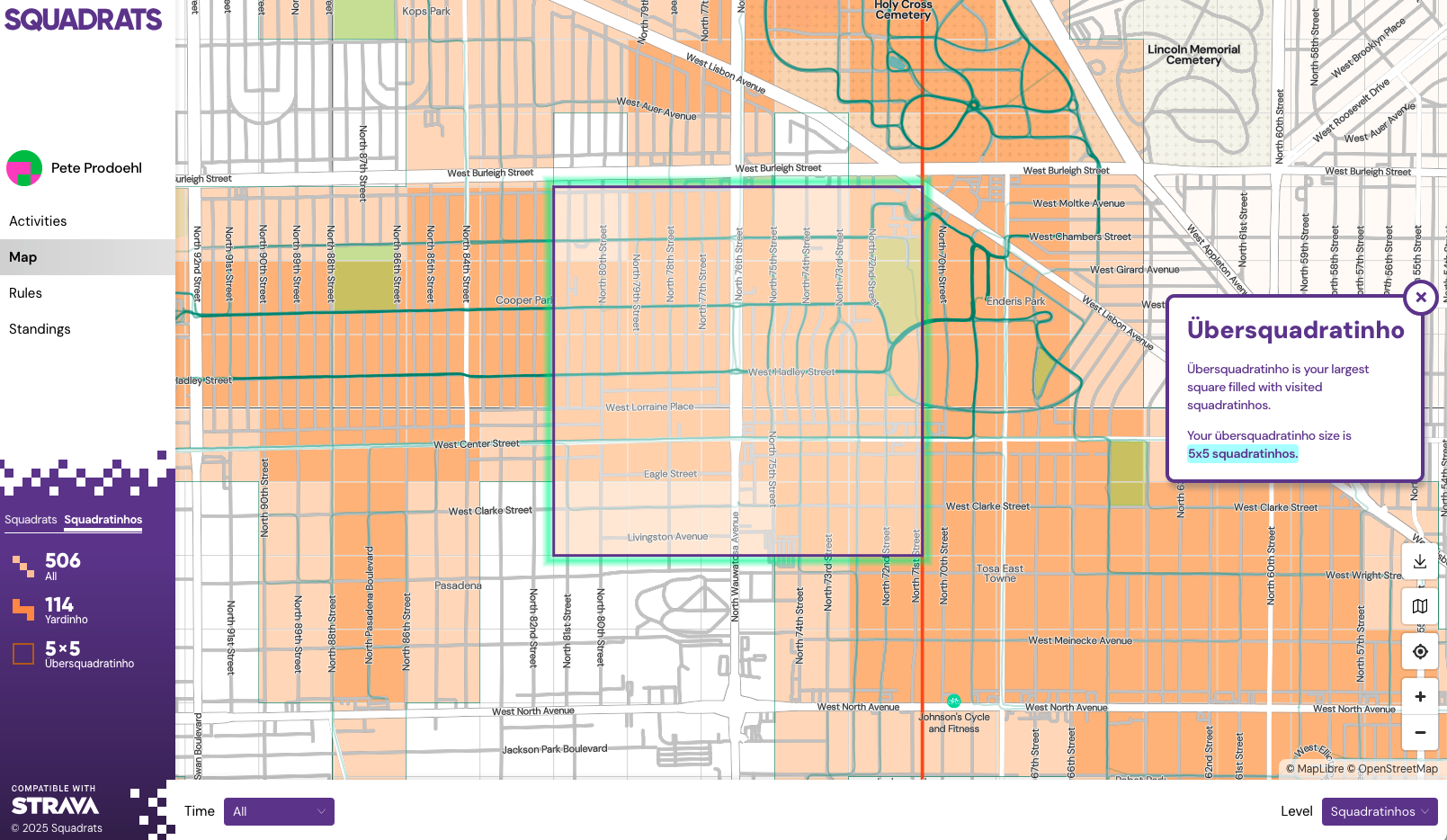
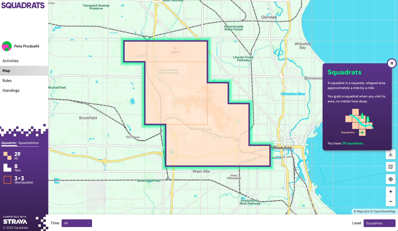
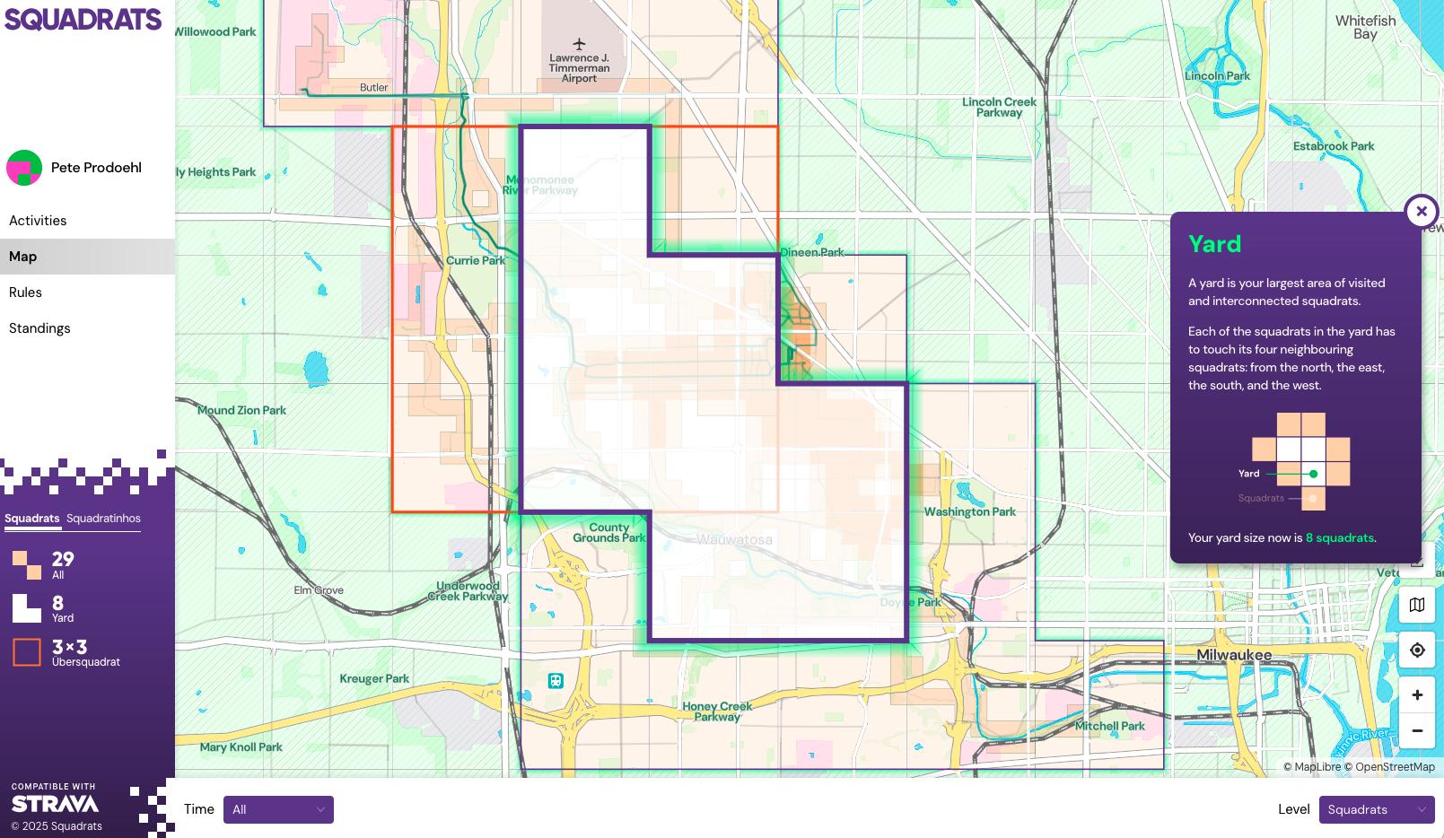
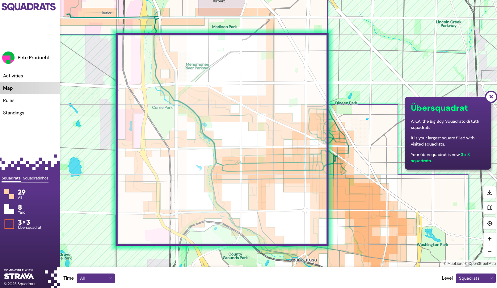
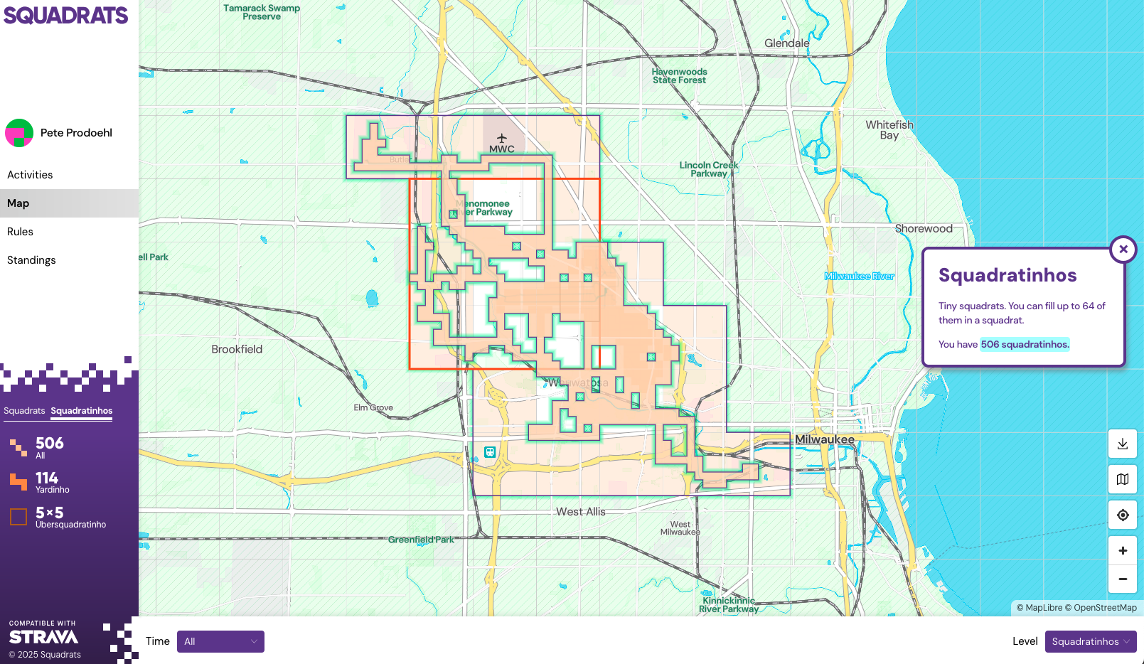
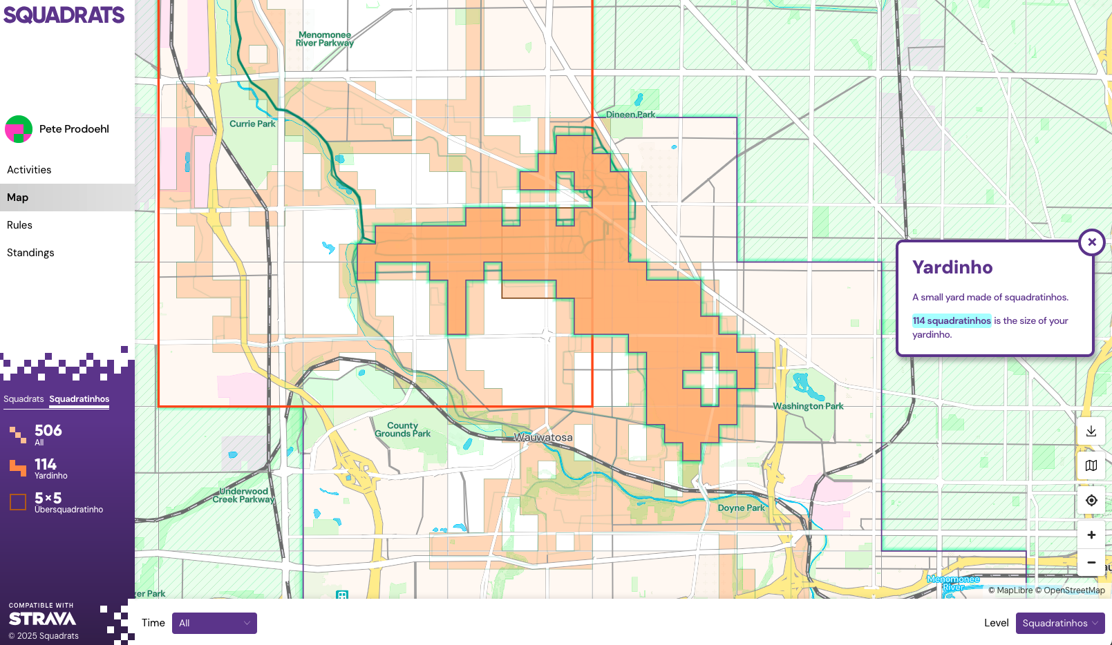
I like most things about Squadrats when it comes to displaying my ride data. It’s great to see a map of where I have been, and you can narrow things by choosing “All time”, “Last 7 days”, etc. and then look at Squadrathinos, Yards, Yardhinos, Ubersquady-somethings, etc. All the terminology is a little weird but whatever.
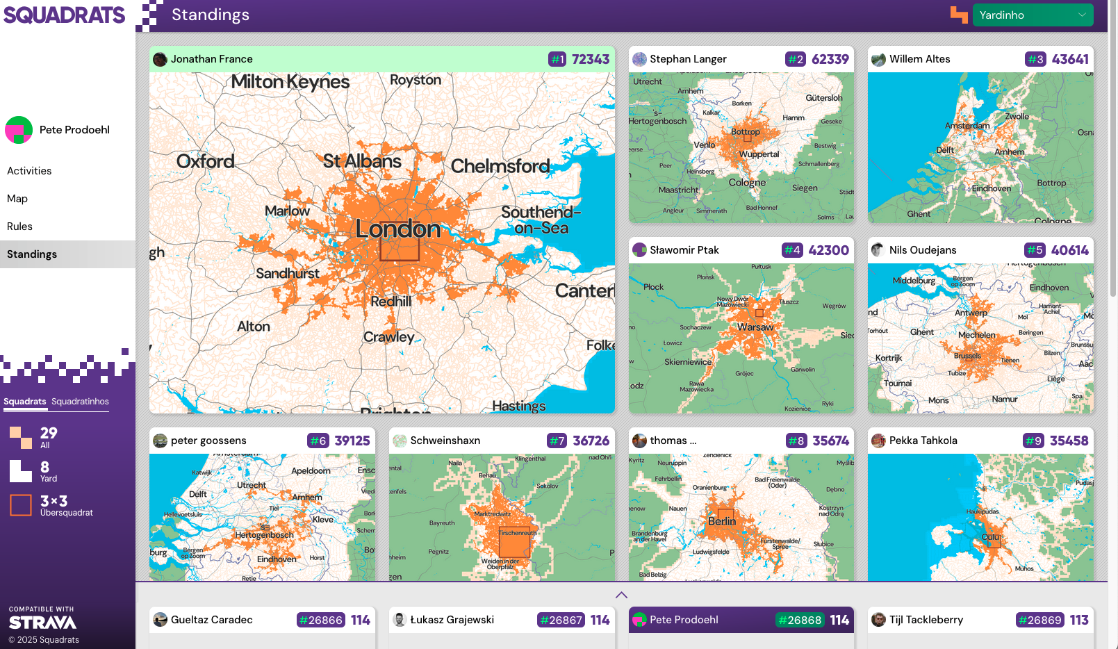
There is a “Leaderboard” and while I’m not out to compete with anyone but myself it’s interesting to see the data. I managed to get about two months worth of data into Strava (and Squadrats) by doing an import from Apple Fitness/Health when I signed up for Strava, but it seems like I can’t easily do that import again, so there’s not a simple way to load all my past data. (There is a way. Looks like I can do it 25 files at a time… I may do that.)
Squadrats is neat, and I do like it… But! I am working on some code to take all of my GPX files from Apple Fitness/Health and plot every ride on a map. I’ll be posting about that soon. Stay Tuned!
Update! I manually uploaded all of 2025’s rides to Strava now and they have flowed into Squadrats so my map covers a lot more area!


 I recently added a Foursquare widget to my blog. It’s in the right column and titled “recently at” and it just displays a short list of recent checkins. (It’s a simple

